

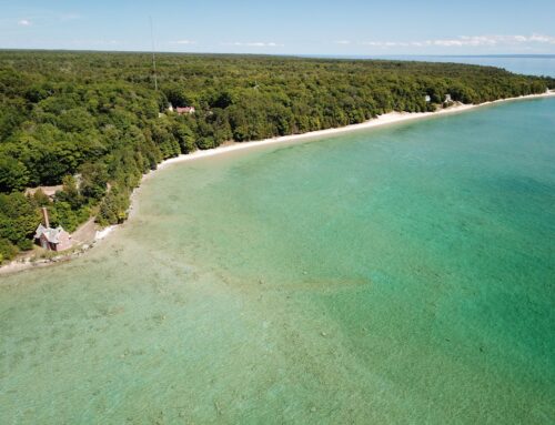
After reading and hearing about a 2.5 mile water-trail through the mangroves in Bahia Tenacatita in this cruising guide we could not wait to go. Especially since there were supposed to be excellent snorkeling and great tacos at the end. We first tried tackling the trail near low water but soon found that we would need a machete or saw to make it through. So we waited a couple of days until high tide was at a more decent hour of the day and tried again – wood chopping tools at the ready.

The first part of the trail is wide open, teeming with fish and birds. About 1.5 miles along it starts to narrow and we had to navigate sharp branches attacking from above and below. Since our dinghy only has two air-chambers we were very mindful not to puncture it. We had already encountered one – albeit small – crocodile.

We chopped a couple of large branches and got a few new scratches but finally made it to the lagoon at the end of the trail where we were expecting to see a small dock and palapa as well as a trail leading to the beach. What we found is some abandoned buildings, a dock that was falling apart and a fence blocking acces to the beach. Since we were up against the clock with a falling tide, we had to either find a way to the beach so we could dinghy back to the boat anchored in the next bay, or hightail it back trough the mangrove trail before it became impassable at low tide.

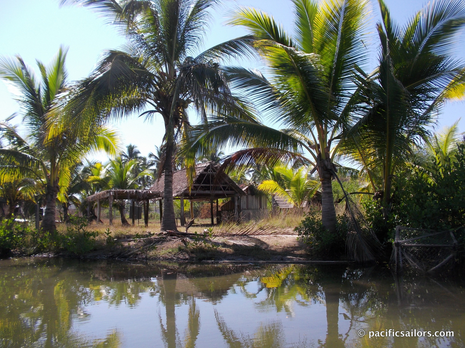

We decided to take a closer look at an opening in the mangroves shortly before the lagoon and found excellent access to the beach. Mike pulled the dinghy through the mangroves, over a small hill and onto a beach (we love our dinghy wheels!) He launched the dinghy to drive it closer to what appeared to be the center of town while I walked along the beach.

After a little while I noticed a man in uniform coming towards me. Since all men of law have been nothing but courteous I kept walking unafraid. He yelled Hola and waved at me, so I stopped and smiled and said Hello. He started talking in fast spanish and I had to explain that I didn’t understand a word. He also looked rather angry. So he called his partner on the radio who drove over in their pick-up. Unfortunately he didn’t speak much english either but after a lot of pointing and talking and my looking baffled I started to get their drift. Apparently we had trespassed and they were not very happy about it. I apologized and said we would not return via the mangrove trail. Then he noticed the camera in my hand and asked if I had taken any photos and wanted to see them. Instead I said we would leave right now and hailed Mike to pick me up. Luckily they just let me go as I ran through the surf and jumped into the dinghy.
The cruising guide in question has not been updated to this day (May 2017) even though I sent them a long email explaining what had happened. They post “updates” to their guide on their website but that has not changed in years. To call it an updated guide is dangerous!
Apparently there has been a serious land dispute in Tenacatita and the land was seized in an armed takeover back in August of 2010. You can read more here…
In June 2013 the new governor kept his campaign promise and opened Tenacatita. The locals are still waiting for legal decision on restitution and the right to rebuild. The guards weren’t allowing photos of what was left of structures because they’re employer was claiming there had been zero destruction.
Is it all just politcal or is there something in there that they want? Or secret. He did ask for pictures.
Now that is pretty sad. another big resort. But at least you had the experience of exploring that area while it’s not crowded with tourists. Cool!